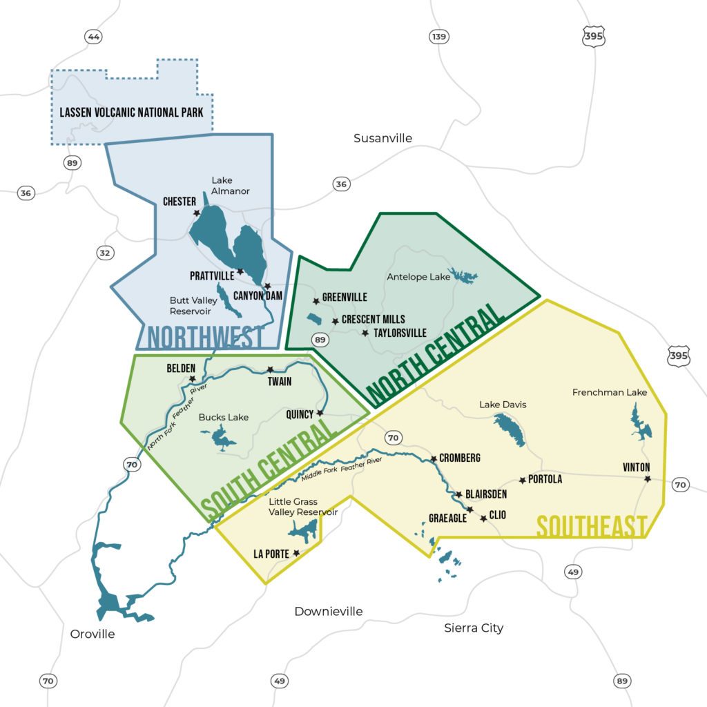
A Lost Sierra Summer Road Trip
Plumas County is beautiful all year, but late spring and early summer offer incredible nature-based experiences for intrepid travelers. If you love birding, waterfalls, and wildflowers without the crowds, this hidden corner of Northern California is your dream destination.
Travel with us on a three or four-day road trip from one end of the Lost Sierra to the other. Visit the expansive wetlands and open vistas of Sierra Valley, follow the Wild and Scenic Feather River, and meander through charming mountain towns en route to little-known trails with waterfalls, wildlife, and botanical wonders.
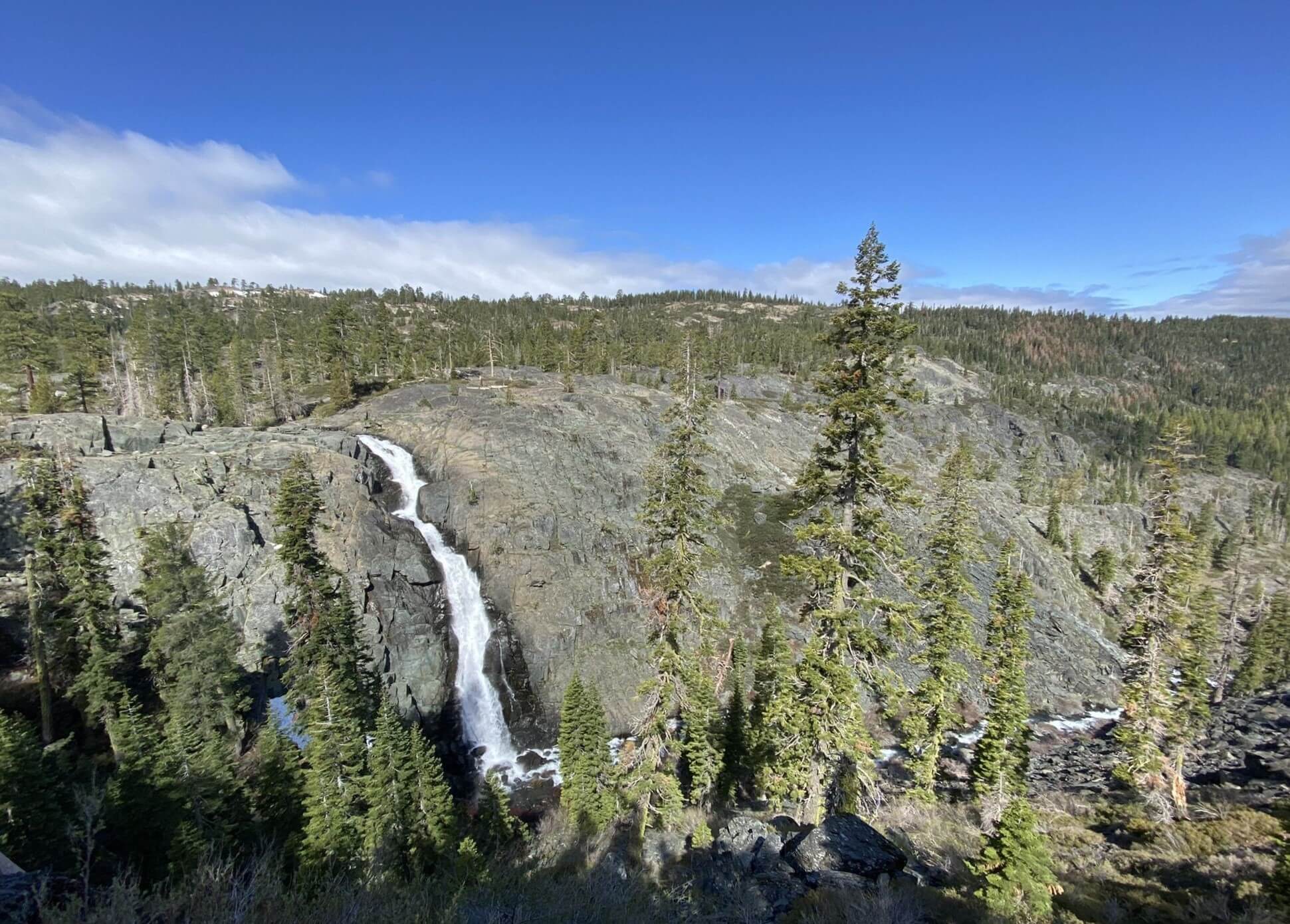
Photo by Lyle Lyle/AllTrails
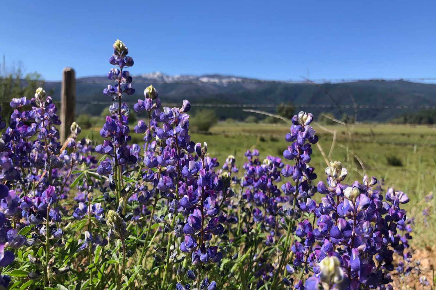
Photo by Vanessa Vasquez
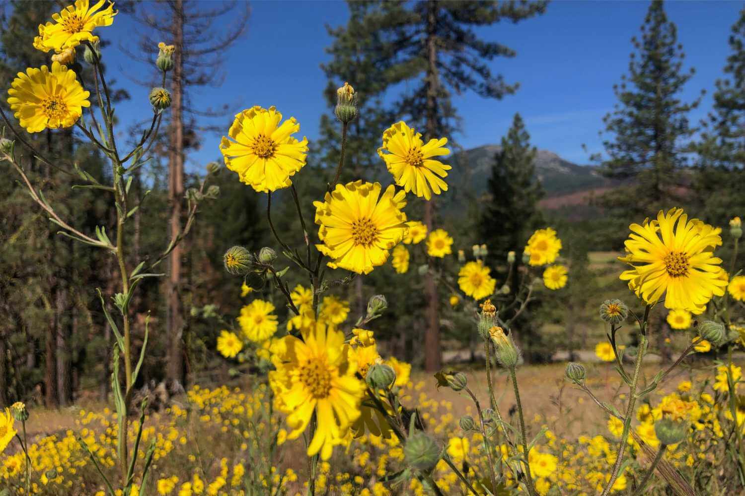
Photo by Vanessa Vasquez
Waterfalls, Wildflowers, Wildlife Road Trip Itinerary
Highlights
A drive through Sierra Valley in eastern Plumas County may have you asking, “Where am I?” but in a good way. This large, high-elevation valley is the headwaters of the Wild and Scenic Middle Fork Feather River and has 360 views of surrounding snow-capped peaks.
Highlights
A scenic drive from Southeast Plumas and the granite boulders of the Lakes Basin west to Highway 70 along ridgelines and the canyon of the Middle Fork Feather River.
Highlights
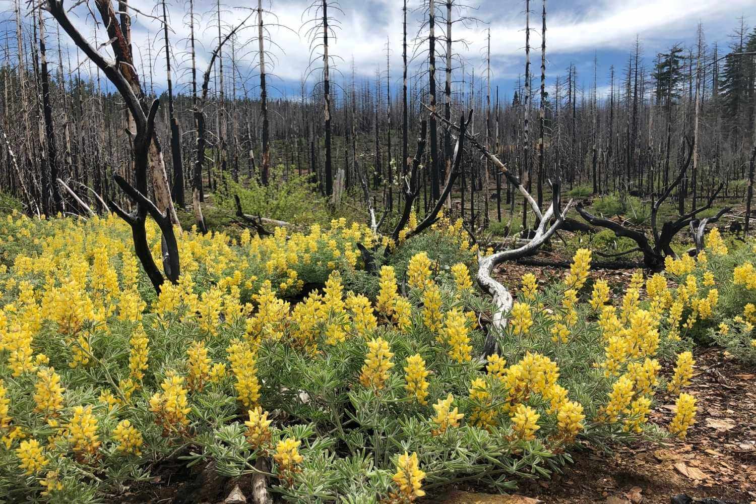
Meander down the dramatic river Canyon west of Quincy and then head upstream through the Dixie Fire scar to see a landscape of resilience and cascading creeks.
Highlights
Leave the Lost Sierra, trek into Volcano Country via Highway 36 or 44, and up the Volcanic Legacy Scenic Byway (89) north to Burney Falls.
A note about this route
If you are traveling from Chico, Redding, or the Northern Sacramento Valley, you can access this road trip route via Highways 32 and 36 and do the trip “backwards” starting in Chester. You can make this into an amazing loop of the Northern Sierra and Southern Cascades by connecting to Hallelujah Junction and Hwy 395 in the east and then traveling north through Susanville, back to Chester. For assistance with trip planning in Plumas County, call 530-280-7187.
When to Go
The best time to take this road trip is after the snow has cleared from all but the high elevations in Plumas County, which ranges each year from early May to the end of June. Even with snow in the high country, much of this route will be accessible by May, with plenty to see. Timing this trip can also depend on your priorities. Birding in the mountain valleys can be pretty exciting in May. However, June and July will have showier wildflowers and better hiking conditions–it’s a choose-your-own-adventure situation!
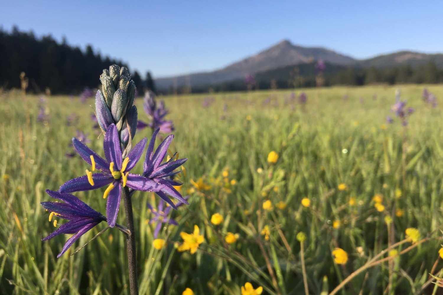
Photo by Vanessa Vasquez
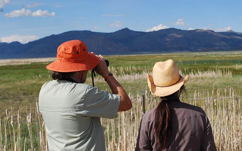
Photo by Katie Bagby/Feather River Land Trust
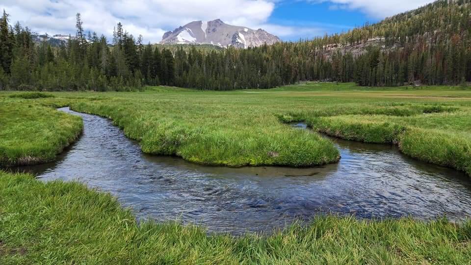
Photo by Beckey Delmonico-Smith
Day 1: Sierra Valley and the Wild and Scenic Feather River
The Route: Reno or Truckee to Graeagle (the long way) via Highways 89, 49, the Beckwourth-Calpine Road, and Highway 70.
Highlights: A drive through Sierra Valley in eastern Plumas County may have you asking, “Where am I?” as you enter another world–the Lost Sierra.
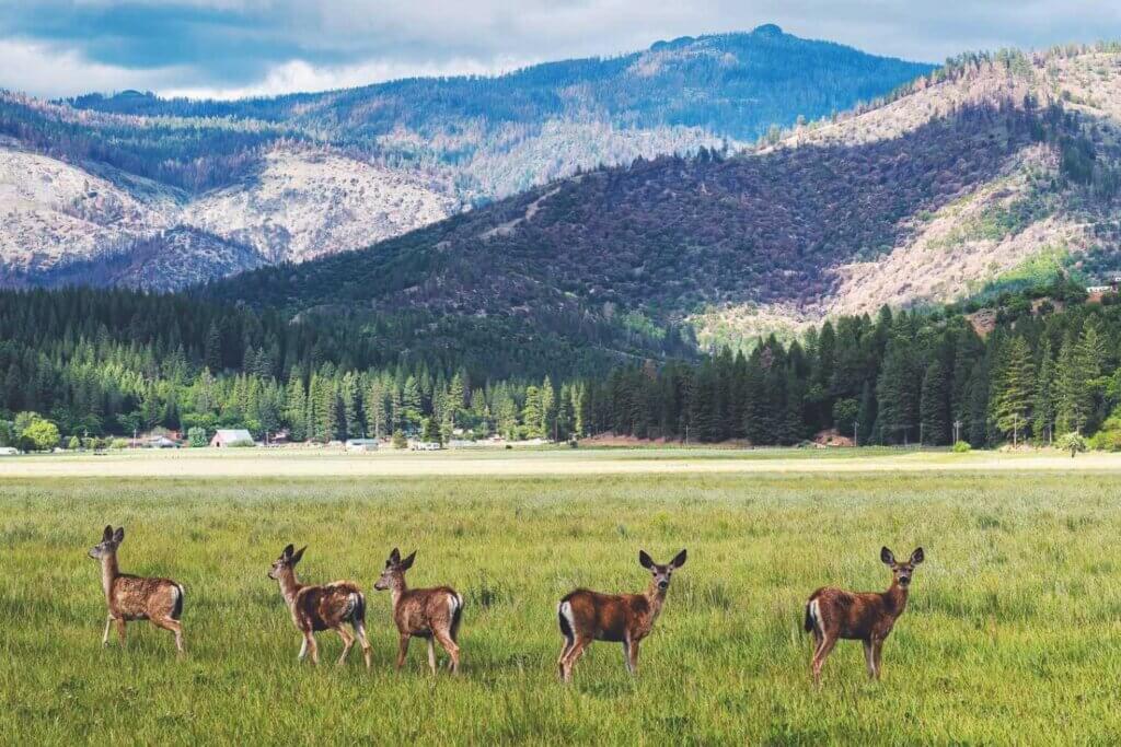
Sierra Valley is a large valley sitting at 4,850’ in elevation with 360-degree views of several mountain ranges. The Valley was once an ancient lake, similar to nearby Lake Tahoe. Today, Sierra Valley has extensive wetlands among sage-brush rangelands and cattle ranches. Be on the lookout for pronghorn antelope and elk returning to the area.
From Reno, travel north on Highway 395 to Hallelujah Junction and the Feather River Scenic Byway (Highway 70). Leave the California/Nevada border and the Basin and Range to enter the high mountain valley on the edge of the Sierra Nevada.
Head north over Highway 89 along the Truckee River from Truckee to Sierraville and Highway 49. Turn north again at Sattley on the Beckwourth-Calpine Road (A23) for a lovely drive along the eastern edge of the valley, skirting Beckwourth Peak.
Sierra Valley is approximately 40 miles from Reno and 50 miles from Truckee. Explore Sierra Valley before heading west down Highway 70 to Portola and Graeagle.
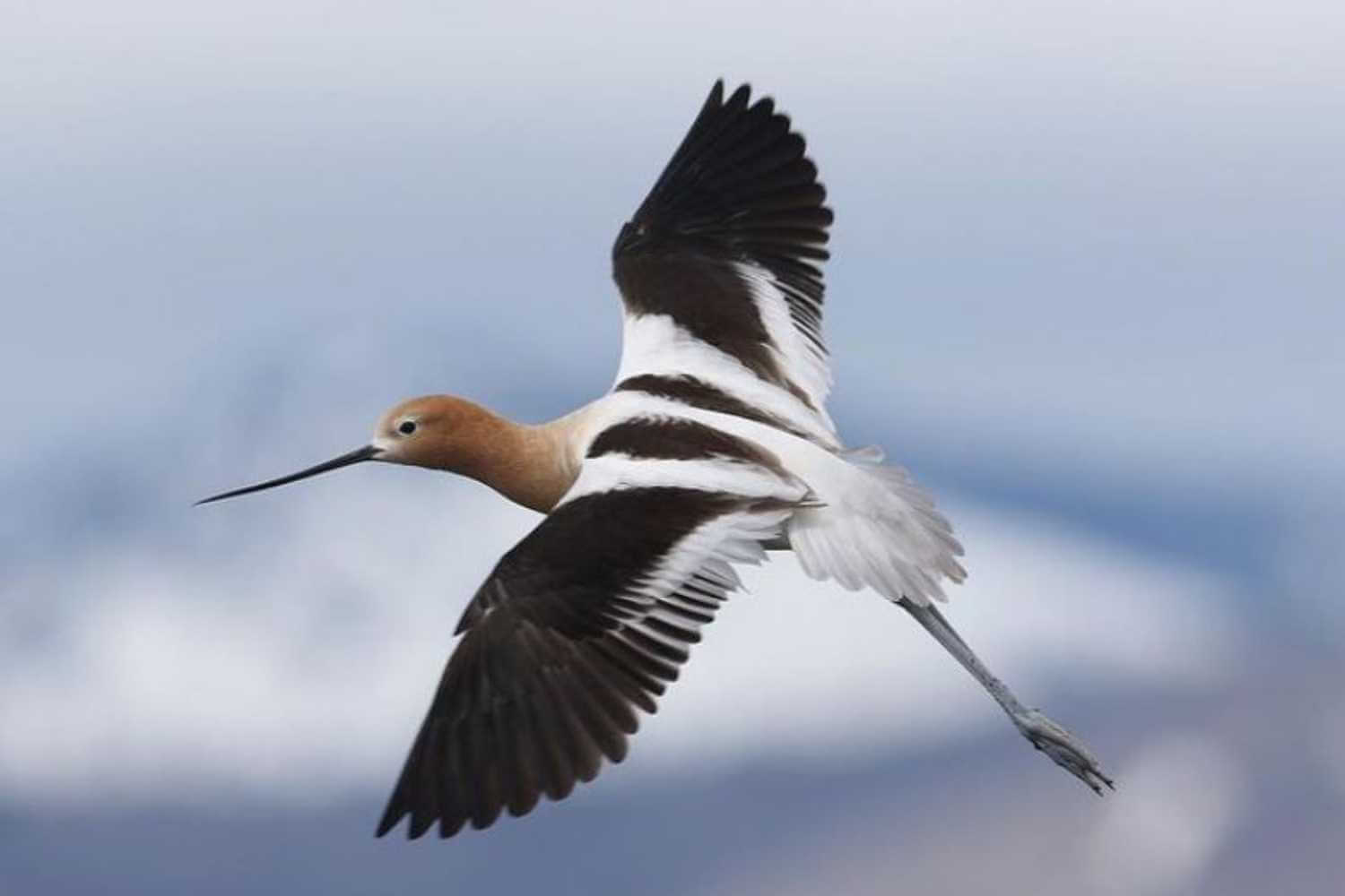
Photo by Micah Silver
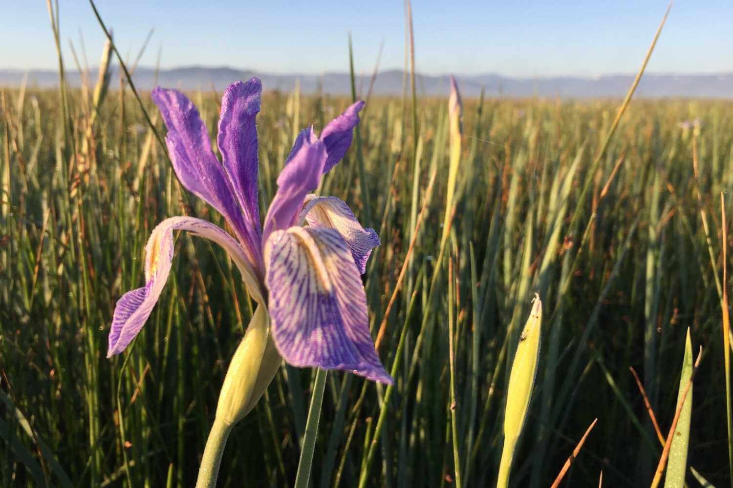
Photo by Vanessa Vasquez
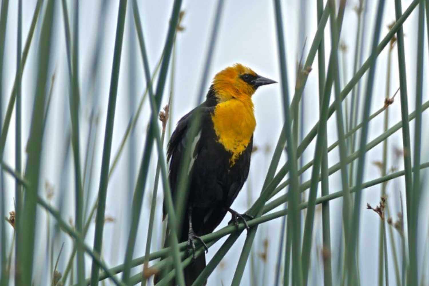
Photo by Betty Bishop
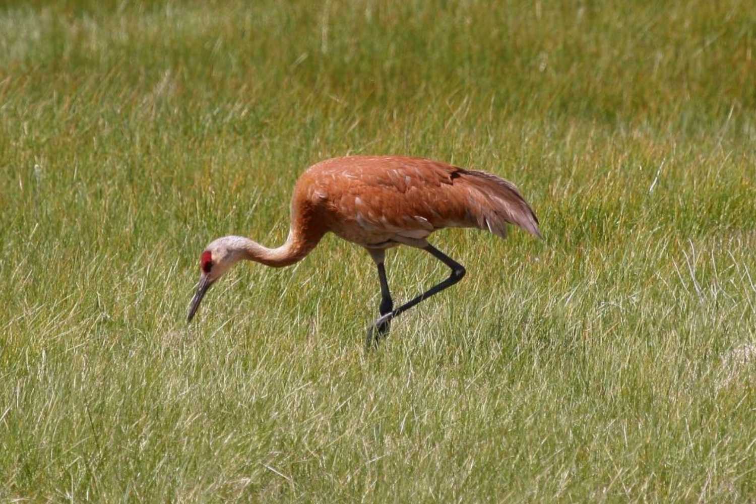
Photo by Mark Kidder
 Goodwin Ranch in Sierra Valley
 Much of Sierra Valley is privately owned, but there is public access at the Sierra Valley Preserve, thanks to the Feather River Land Trust. The Sierra Valley Preserve is a great place to go birding, see wildflowers, and learn about this unique ecosystem. The months of May and June are a great time to see wildlife and flowers, including Beckwourth’s violets, Brown’s peonies, Hooker’s balsamroot, larkspur, camas lilies, blooming bitterbrush, and more. Visit FRLT’s Sierra Valley Preserve page to learn more about this first destination of the trip.
Another popular Sierra Valley birding spot is the Marble Hot Springs Road steel bridge. Google Maps has this location named “Marble Hot Springs Bridge.” Look for white pelicans, avocets, white-faced ibis, American bitterns, swallows, ducks, and short-eared owls.
After a morning of exploring Sierra Valley, head west to Portola and Graeagle for your afternoon sightseeing. Portola has several great restaurants, including local favorite Rico’s Mexican Restaurant. If you are looking for a healthy grab-and-go lunch, the Feather River Food Co-op is a friendly, small-town grocery store with fresh soups, sandwiches, and organic snacks. Just down the street from the Co-op is a short, paved path with benches overlooking the Feather River–perfect for a lunch stop.
Graeagle is a picture-perfect mountain town near the Middle Fork Feather River with iconic red cottages, a large public lawn, quaint shops, and adorable vacation rentals. On many weekends, you can find live local music and events happening around the Mill Pond and Main Street.
If you are a beer lover, you are in luck! Just outside of Graeagle are two award-winning breweries– The Brewing Lair and Ronin Fermentation Project. Both are worth the visit.
If you are traveling with the family, the Graeagle Frosty is a popular post-hike destination for hungry explorers. Grab your order and head to the Mill Pond for a picnic!
Day 2: Lakes Basin Waterfalls to Quincy
The Route: Graeagle, up to the Lakes Basin, then west to Quincy
Highlights: A scenic drive from the granite boulders of the Lakes Basin west to Highway 70 along ridgelines and the canyon of the Middle Fork Feather River.
Day two of our waterfalls, wildflowers, and wildlife tour has a short drive up in elevation to start the day. This well-worth-it excursion is dependent on the snow level, so check road conditions for Gold Lake Road and Fraizer Falls Road before you go. If you find yourself on the early end of the road trip season, simply head west to Quincy, which sits lower in elevation and has plenty to do.
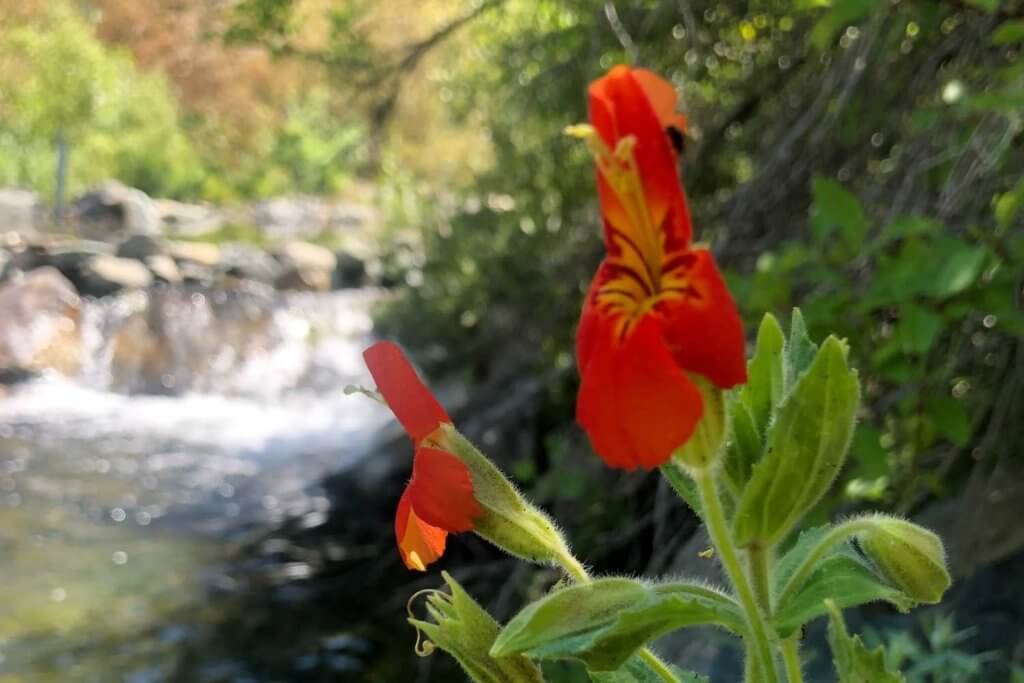
From Graeagle, head south on Highway 89 to Gold Lake Road and begin climbing up into the Lakes Basin Recreation Area for TWO wonderful waterfalls! The first stop is Fern Falls Overlook Trail. The trailhead is located on Gold Lake Road about 6 miles from Highway 89. The trail is short but rocky, with big granite steps and gorgeous views. Look for penstemons, mountain lilac, and mariposa lilies growing in rocky soils. Please note that the trail can be hard to follow at times, but if you generally follow the creek, you will find the falls!

Photo by Hailey Cowden
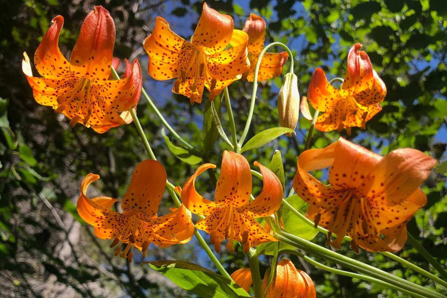
Photo by Vanessa Vasquez
Photo by Lyle Lyle/AllTrails
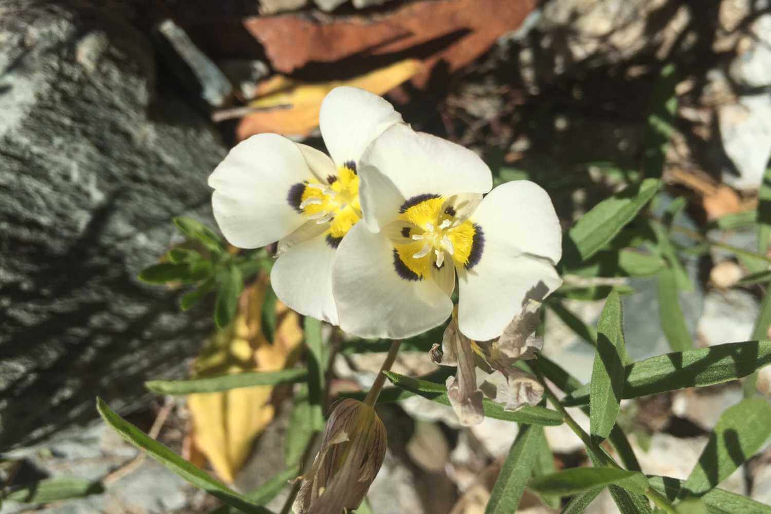
Photo by Vanessa Vasquez
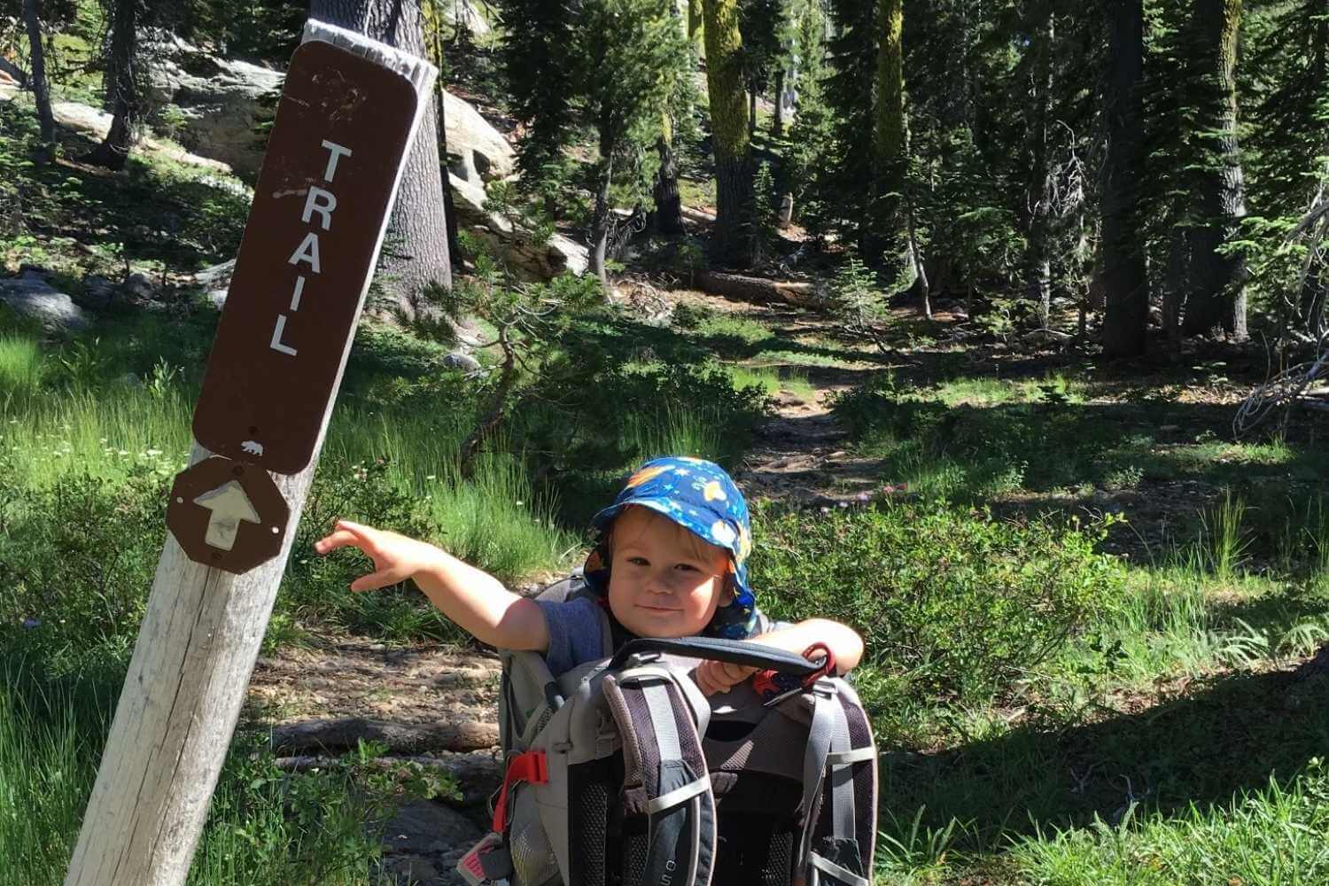
Photo by Jared Picou
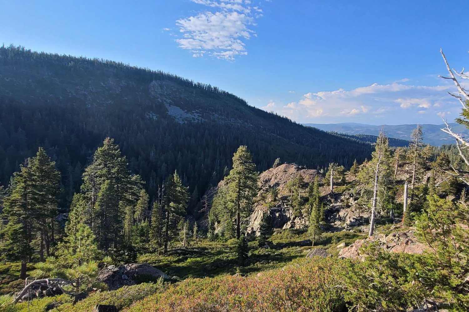
Photo from AllTrails
The second stop is Frazier Falls, a beloved destination in Plumas County. This one-mile, accessible trail is paved for all outdoor enthusiasts (perfect for little ones too). And the view of the glacially carved waterfall canyon is amazing! Frazier Creek falls nearly 200’ feet making it the tallest waterfall in Plumas County. Along the trail look for flowering buckwheats, Indian paintbrush, lupine, and larkspur. The trailhead for Fraizer Falls is on Frazier Creek Road, which connects to Gold Lake Road, making it an easy drive back down to Graeagle once you’ve taken in the High Sierra sights.
To finish out your day, continue west on Highway 70 to Quincy–the quirky county seat for Plumas County.
Explore Quincy
Quincy has a walkable, historic downtown and many quaint lodging options. The community’s strong commitment to the arts means you’re bound to find gallery openings, performances, or live music on any given weekend throughout the year.
There are some fun food options in Quincy. No road trip is complete without a milkshake and fries! Try the Quincy “frosty”, The Polka Dot for delicious soft serve and quality salads, hamburgers, and sandwiches thanks to new foodie owners. Quintopia, Quincy’s homegrown brewery, features elevated pub fare in addition to refreshing ales, plus indoor and outdoor dining. Looking for something more romantic? The Drunk Brush wine bar is a great place to start a date, and the Wildflower Café has house-made pasta and Mediterranean dishes. Before starting your adventure the following morning, be sure to try Patty’s Thunder Café for a hearty breakfast, Quincy Provisions for pastries and coffee, and stop by the natural food co-op on Main Street to resupply.
If you are looking for more to do in the great outdoors, here are some of Quincy’s best trails and activities.
Close to downtown Quincy is a short nature trail with interpretive signs offering visitors an opportunity to walk out into American Valley. The trail follows a canal and has a meadow and riparian habitat home to ducks, red-wing blackbirds, harriers, hawks, beavers, and more. The local land trust owns and manages this trail as an outdoor classroom for nearby schools. This valley trail is exposed and can be hot in the summer. It is best to visit in the early mornings and evening when temps are cooler and wildlife are more active.
Looking for a good uphill and some beautiful views of the mountains and creeks around Quincy? Try the Spanish Ridge Loop in the South Park Trail System. In late spring and early summer, this trail offers lots of wildflowers like shooting stars, yerba santa, California poppies, lupines, native morning glory, and more. Plus, when it is very hot, you can take a dip at the swimming hole at the start of the trailhead–a local favorite called Oakland Camp on Spanish Creek.
Quincy is also known for great mountain biking. If you enjoy fast, forested trails and downhill, be sure to visit Yuba Expeditions to rent a bike, get a shuttle, or buy a trail map. The South Park Trail System and the world-famous Mt Hough downhill are just a stone’s throw from downtown.

Photo by Samantha Rose
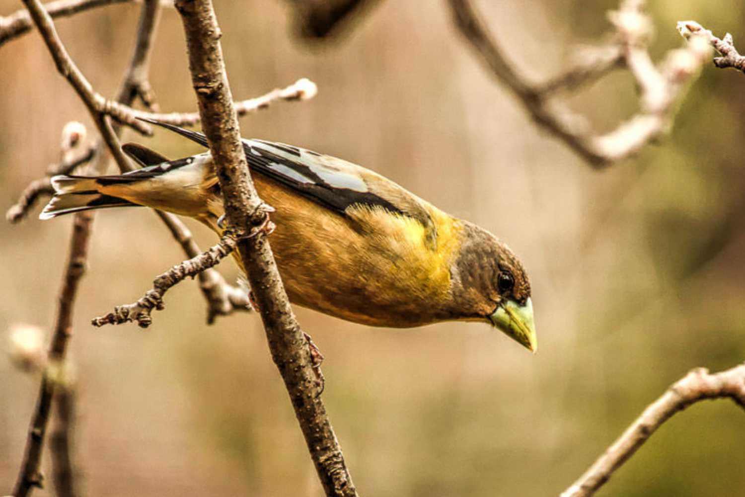
Photo by Michael Beatley
by Vanessa Vasquez
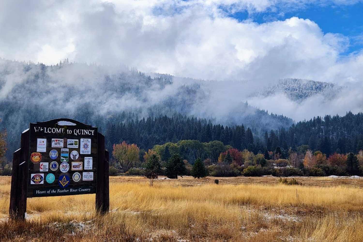
Photo by Jeff Titcomb
Day 3: The Cascades, Indian Falls, and Lake Almanor
The Route: Quincy to Spanish Creek to Lake Almanor through Indian Valley
Highlights: Meander down the dramatic river canyon west of Quincy, then head upstream through the Dixie Fire scar to see a landscape of resilience and cascading creeks.
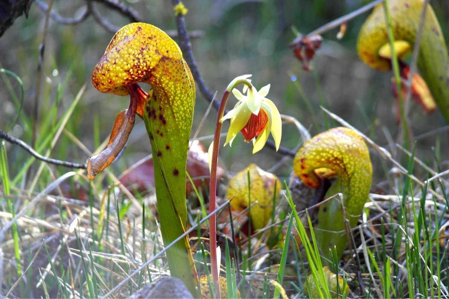
Day three has three stops before the final destination–Lake Almanor. The day starts with a short drive to forest service roads and the beautiful and unique Butterfly Valley Botanical Area. This special spot in Plumas National Forest was thankfully spared by the Dixie Fire, although you will drive through an area of high-severity forest fire en route. The botanical area has many types of orchids, California pitcher plants, sundews, lilies, and other unusual flowering plants. Peak bloom time is May-early July. Follow the detailed directions on the Plumas National Forest page to access Butterfly Valley.
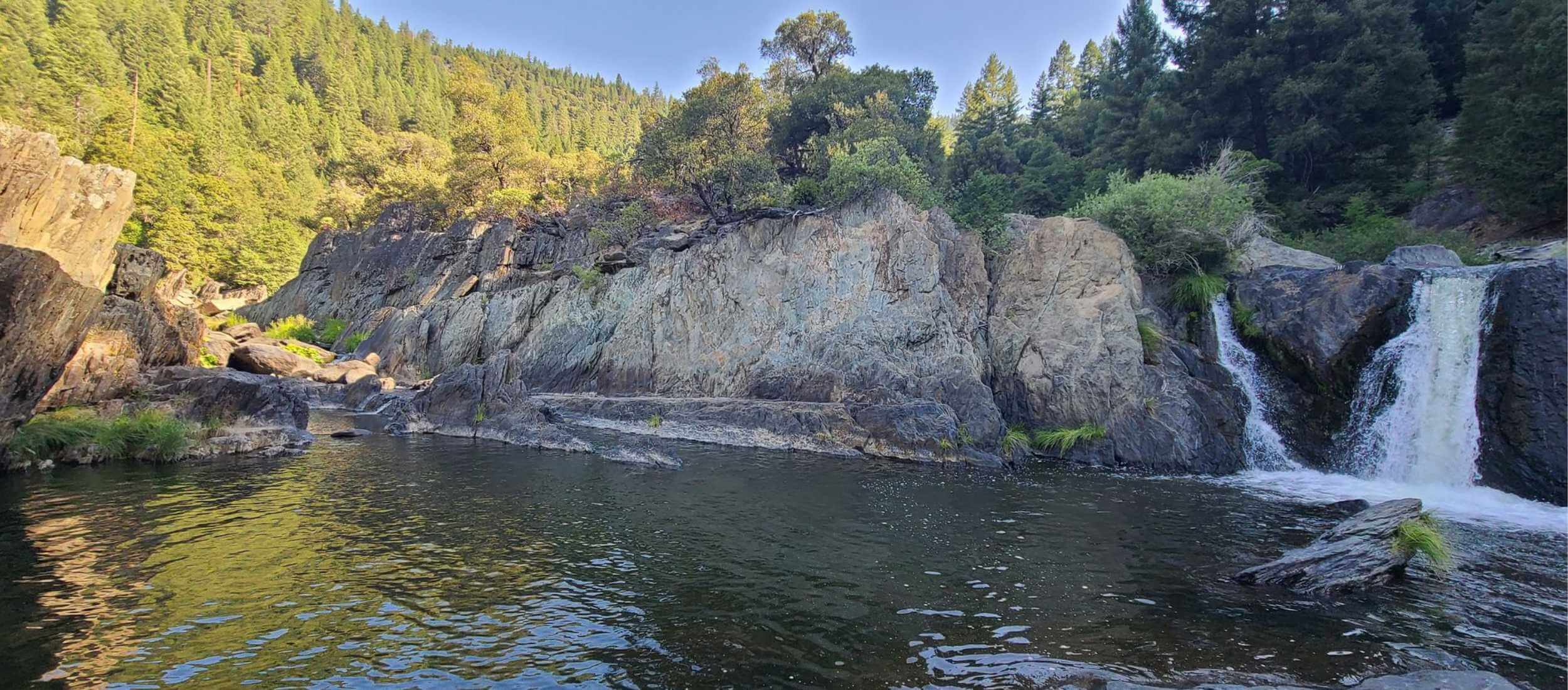
The second stop is one of the most beloved trails in Plumas County, the Cascade Trail. Because this trail is lower in elevation, it can be hiked most months of the year. In spring, it is especially exciting because it follows the dramatic Spanish Creek canyon to a staircase cascade of carved boulders. Head west down Highway 70 to Old Highway Road to access this trail. Follow Old Highway along the creek and look for a trailhead and dirt road to the right. Take the dirt road to the Cascade Trail parking area and day use. The Cascade Trail is located about 6 miles from Quincy. The hike is an out-and-back and follows the creek upstream through the forest on a mostly gentle, rolling trail. About 1 mile up, you will see the Cascades.

Photo by Jolena Astin
by Mike Nellor
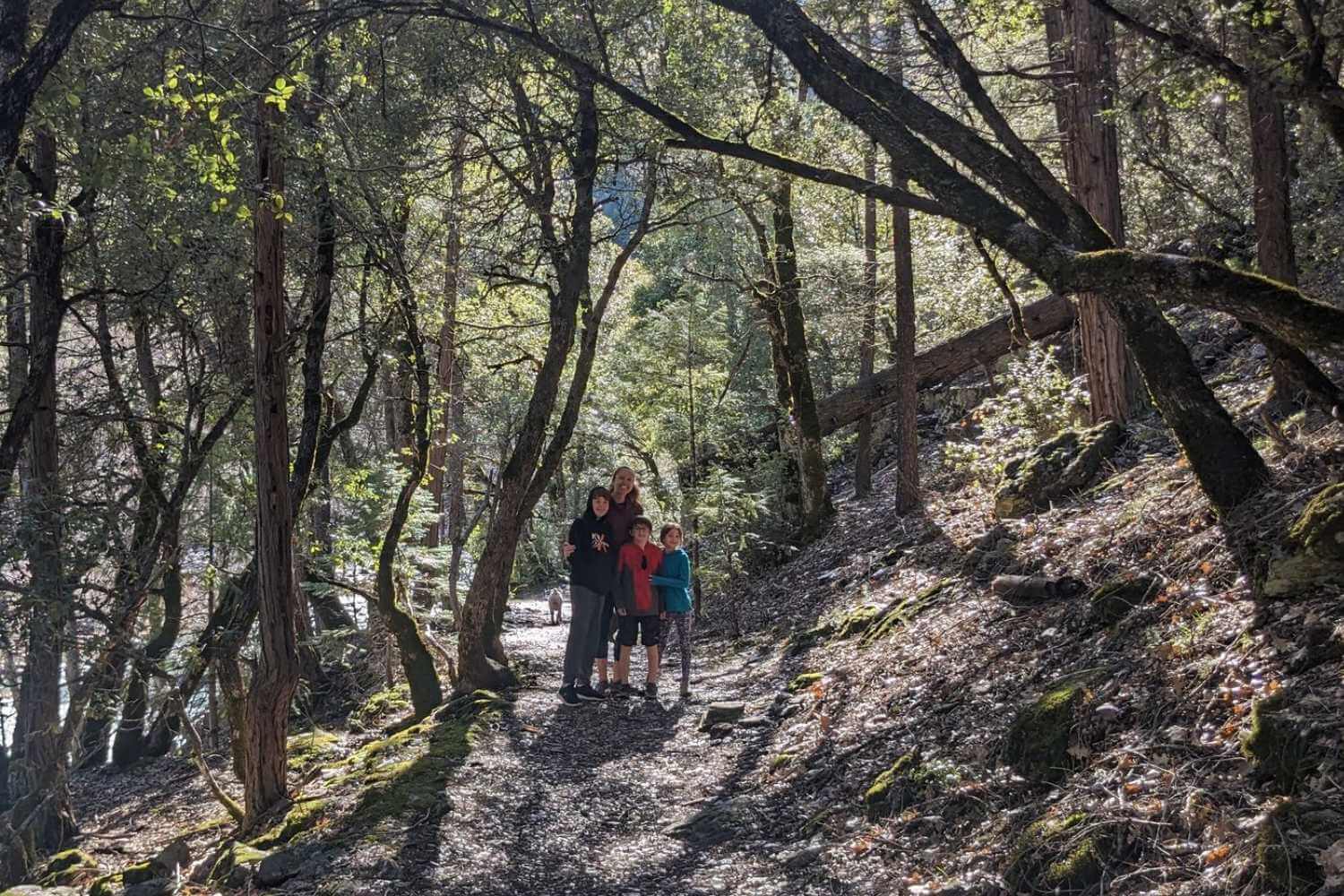
Photo by Joel Splawn
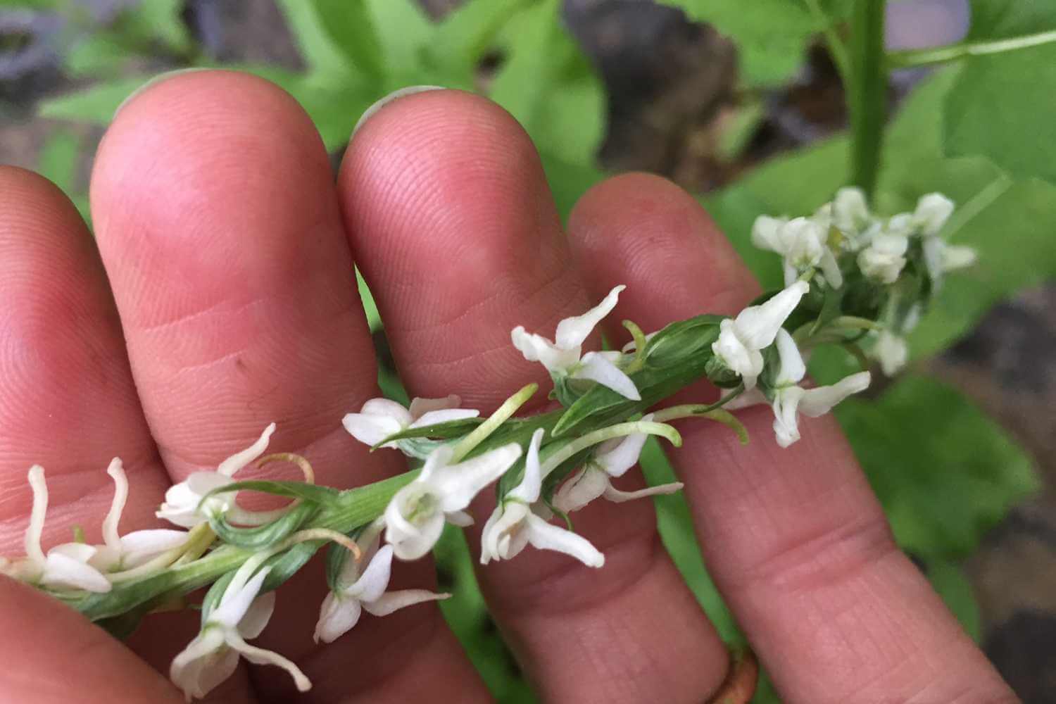
Photo by Vanessa Vasquez
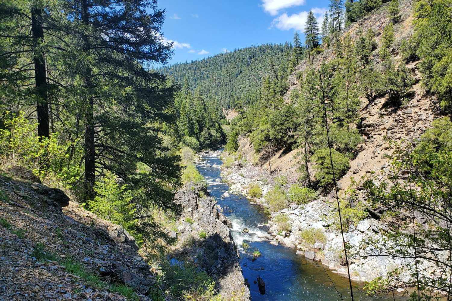 The view of Spanish Creek from the Cascade Trail
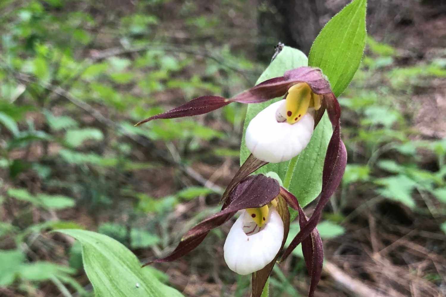
by Vanessa Vasquez
Indian Falls to Lake Almanor
Continue west down Highway 70 to the Greenville Wye and the junction of Highway 89. Head north on 89 to the third stop of the day–Indian Falls. Indian Falls is an impressive, wide waterfall with a large pool (and sometimes a sandy beach). It’s a local favorite swimming hole for a good reason. The hike is short and a little steep, and it has interpretive signs about native plants in both Maidu and English. This would make a great picnic spot and photo opp before continuing on.
After leaving Indian Falls, the road continues to meander along the creek with vibrant green oaks and willows. You may peep some poppies and lupines in the fire scar along the canyon walls.
The road opens up to Indian Valley, named for the Native American Maidu, the valley’s original inhabitants. Much of Greenville was destroyed on August 4th, 2021, by the Dixie Fire. There is a massive effort by the Greenville community to rebirth their community, but it will take many years. Stop and show your support by visiting the businesses that have been rebuilt. For some of the best jerky anywhere, check out Riley’s Jerky.
Continuing north on Highway 89, you’ll reach Lake Almanor. Nestled along the banks of the North Fork of the Feather River, Chester offers vintage charm with unique shops, parks, and museums. This is the perfect place to end your day with great restaurants and cozy lodging.

Photo by Brandi Howard
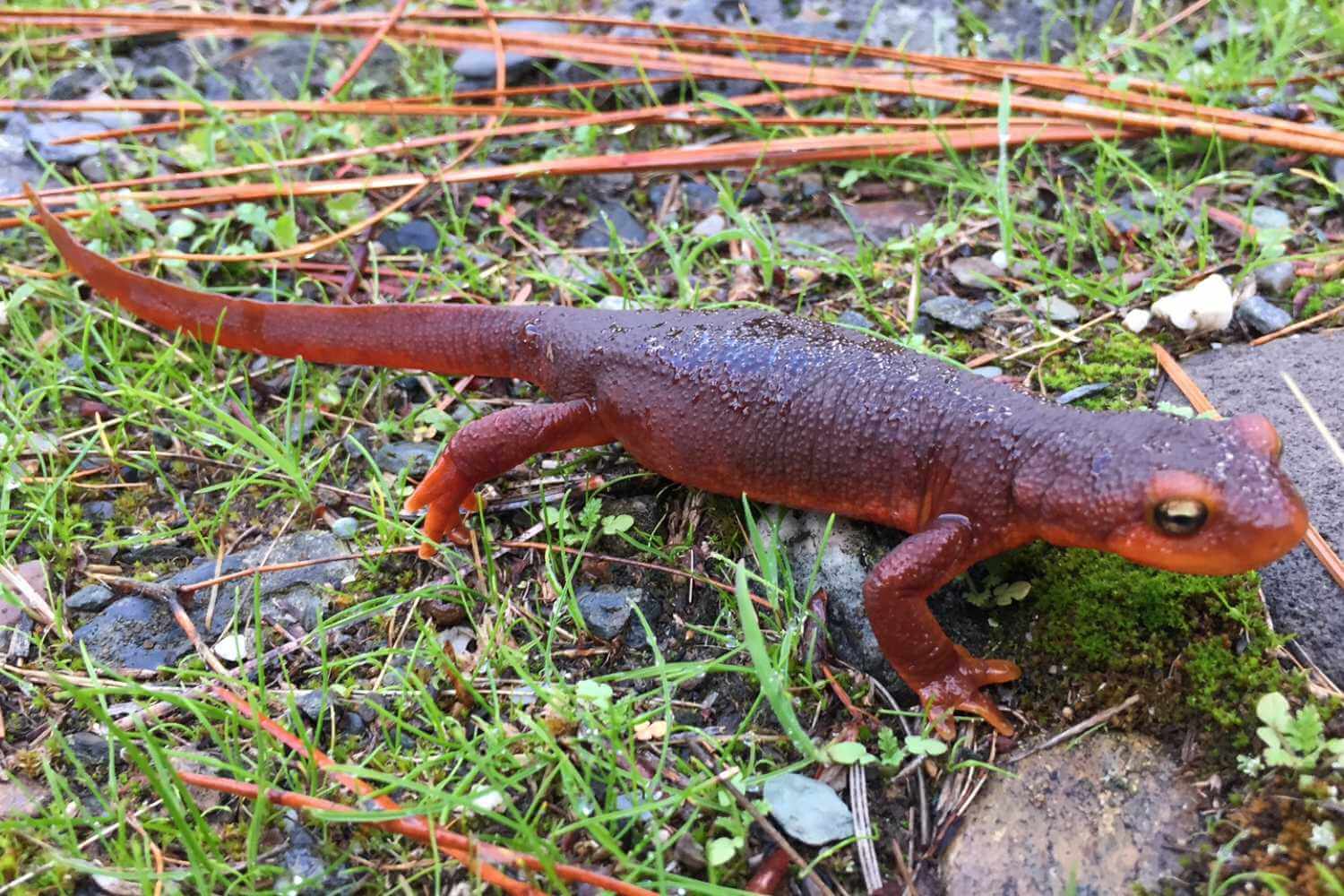
Photo by Vanessa Vasquez
Explore Chester and Lake Almanor
Chester is known as the gateway to Lassen Volcanic National Park and Lake Almanor. The small town is surrounded by public lands. If food and drink are calling you after a long day of adventure, try the newly renovated Timber House Brewery for steaks, salads, brisket sandwiches, and more. The Pine Shack Frosty is a Chester classic for locally owned, quality fast food. Before you hit the road the next day, Cravings is a great place for breakfast or brunch. Depending on where you stay, there are also great restaurants on the Peninsula of Lake Almanor and the West Shore.
If you are looking to do some more exploring in the Lake Almanor Basin, here are some other special places perfect for birding and wildflower walks.
Tásmam Koyóm is a big mountain meadow that was returned to it’s original inhabitants, the Mountain Maidu, in 2019. This Maidu-owned land was formerly called Humbug Valley and owned by PG&E. Public access continues. This special place has Big Springs and the headwaters of Yellow Creek. It is a great place to see both wildflowers and wildlife. Access is best in June when the dirt roads are clear of snow and mud.
Take Highway 89 to the west side of Lake Almanor. Turn off on Humbug Road, a gravel road, and go about 10 miles across Humbug Valley. Just West of Humbug Valley, several roads intersect. Turn left (south) onto Forest Road 26N08. After one mile, turn left onto an unmarked spur road to find Big Springs and Yellow Creek Campground.
The Olsen Barn Meadow, just east of downtown Chester, is a park-preserve with access to a 140 year-old historic barn and the North Fork Feather River. It’s a great place to enjoy wildlife and go birding. Look for flycatchers, warblers, sandhill cranes, osprey, and eagles.
Day 4: Volcano Country and Burney Falls
Route: Chester to Lassen Volcanic National Park off Highway 36 for Kings Creek Falls and continue on Highway 89 to Burney Falls
Highlights: Leave the Lost Sierra and trek into Volcano country via highways 36, 44, and up 89 north to Burney Falls.
On your last day of this epic adventure, you will leave the Lost Sierra and travel into the Southern Cascades. Lassen Volcanic National Park and the surrounding region has beautiful waterfalls, geothermal features, interesting volcanic terrain, glacially carved lakes, and miles of hiking through mountain meadows filled with flowers. This portion of the road trip is also dependent on snow levels and your route preference–choose your own adventure!
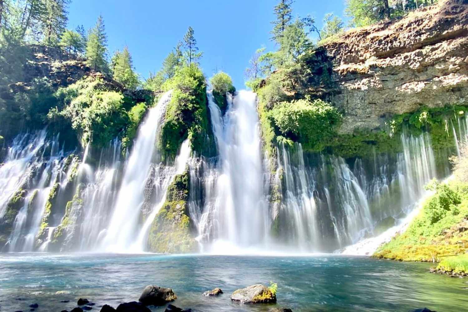
Photo by Mark Bajzer
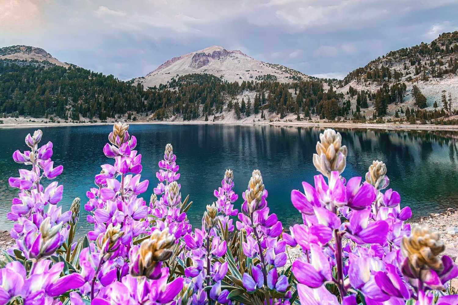
Photo by Jake Edwards/Scenescapery
Option 1: Best for late June, July, or August. Travel on Highway 36 west from Chester through Childs Meadow and up to Highway 89 to enter the Park’s southern entrance. Stop by the Kohm Yah-mah-nee Visitor Center for a park brochure and to get the lay of the land. Part of the park burned in 2021, so make sure the trails you want to hike are open. Another good idea is to download the NPS app for Park updates and current conditions.
Kings Creek Falls Trail is highly recommended for a beautiful meadow experience and wildflowers like larkspur, mules ears, arrowleaf balsamroot, fireweed, and much more. The trail is approximately 2.5 miles and does have a steep descent to the waterfall overlook. Please note that no dogs are allowed on trails in the National Park. Kings Creek, rushing with snow melt, falls 30 feet and has a lovely view of the canyon and mountains beyond.
After enjoying a hike and some geothermal sightseeing, If you are feeling the call north, the drive through Lassen Volcanic National Park on Highway 89 is truly remarkable. From this point in the trip you can choose to continue on to McArthur-Burney Falls Memorial State Park for one of California’s most beautiful waterfalls or return to Chester and Lake Almanor for more sight-seeing there.
 Flower-lined trail to Mill Creek Falls in Lassen.
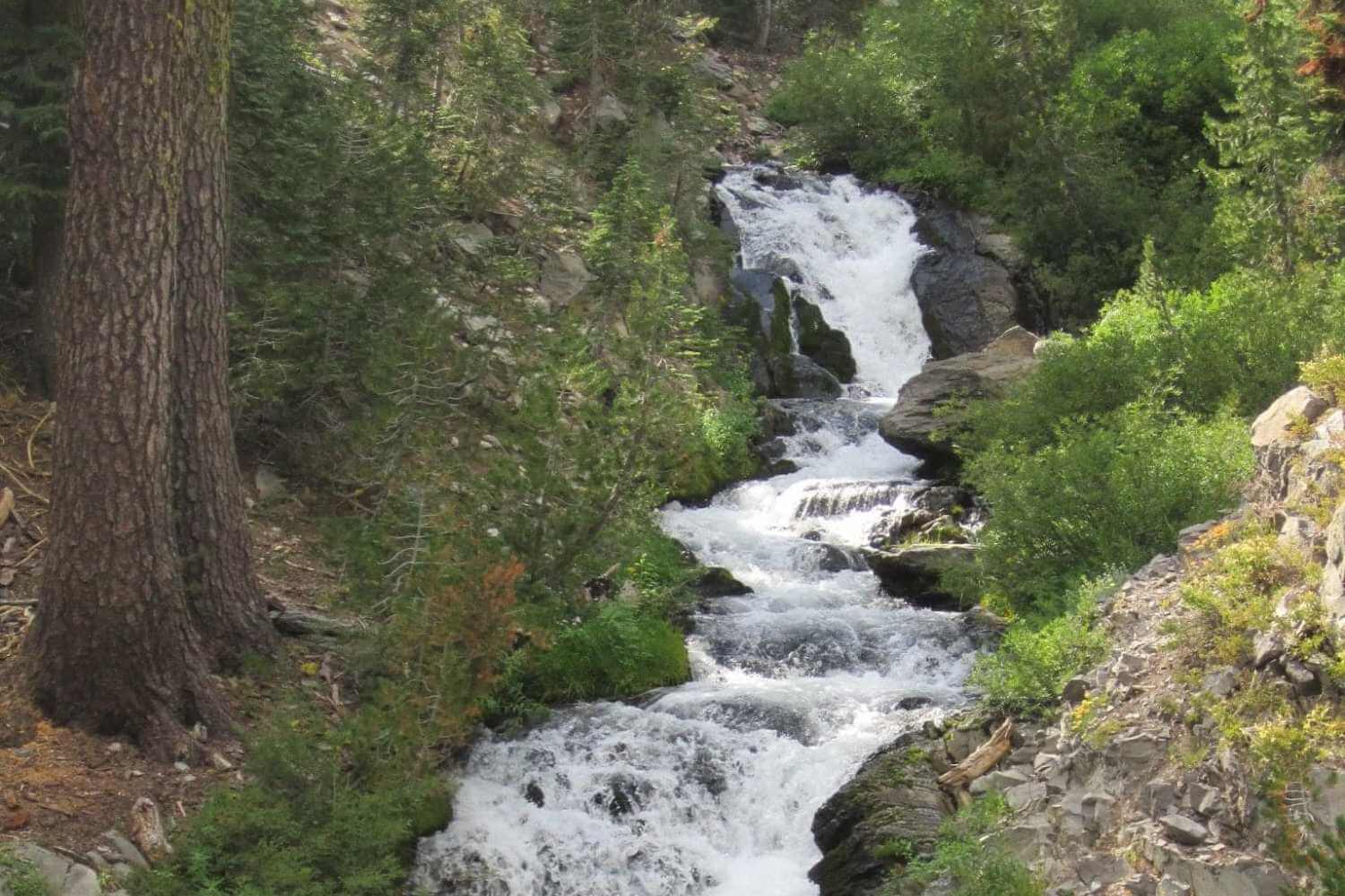
Photo by Lene Langpap Fjordvald
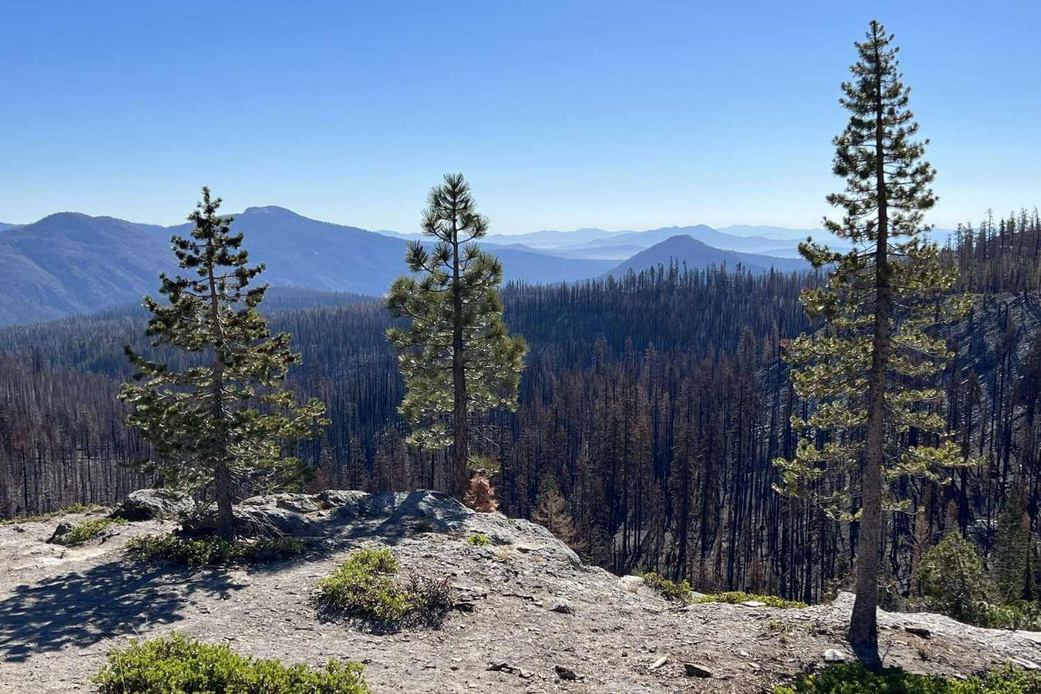
Photo by Joe Kruzel
Option 2: Best for May, early June, or before the road in Lassen Volcanic National Park opens. From Chester, drive east on Highway 36 to Highway 44. Head north on Highway 44 and meander through volcanic terrain and high mountain meadows in this rural stretch of Northeastern California. Stop at the Hat Creek Rim Scenic Overlook for a bathroom break and take in the amazing view. Continue on to Old Station and the Junction with Highway 89. A fun side excursion along the way to Burney Falls is the Subway Caves Lava Tubes in Lassen National Forest. This self-guided ⅓ mile cave adventure is DARK! So don’t forget your flashlight.
The Pacific Crest Trail also passes across Highway 44 near the junction with 89. This is another good opportunity to get out and hike and explore the interesting volcanic terrain.
The next stop is the last stop on this trip–Burney Falls!
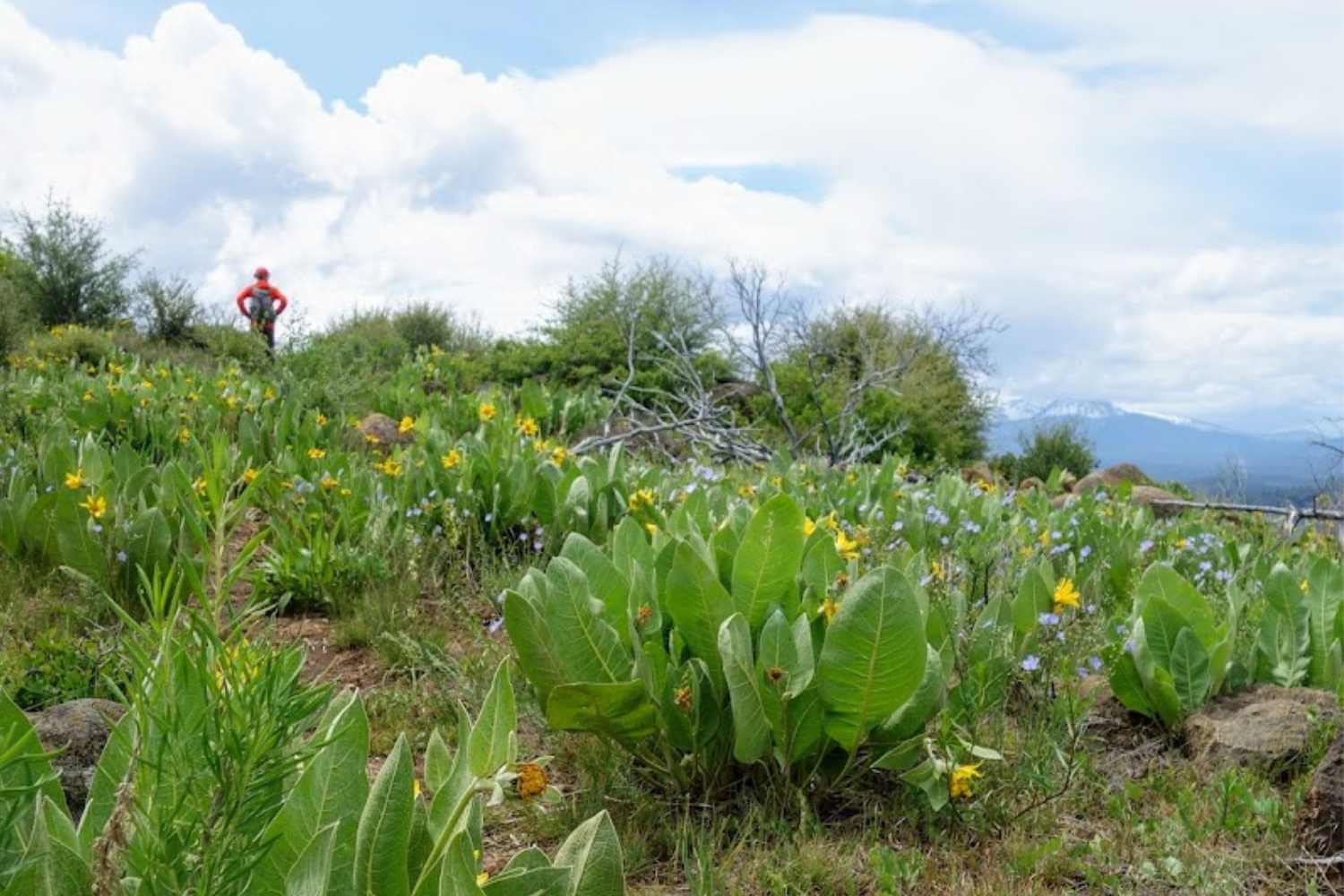
Photo by Jan’s Jaunts
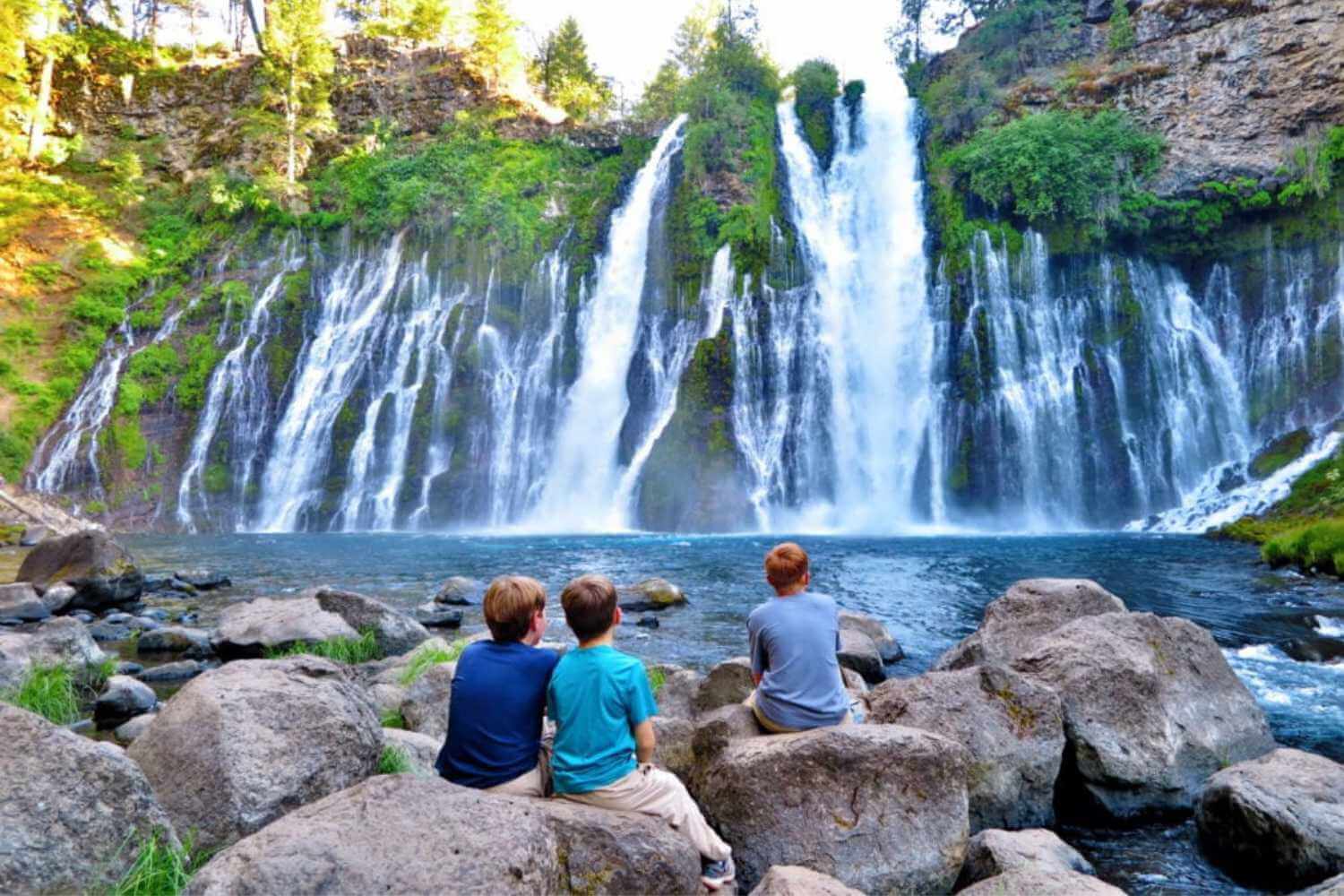
Photo by 10 Traveling Feet
Burney Falls
Burney Falls is located in McArthur-Burney Memorial State Park near the Pacific Crest Trail, Lake Britton, and Highway 89 in Shasta County. The 129-foot waterfall is lush and large all year-round and known as one of California’s most beautiful waterfalls. Burney Creek originates from the park’s underground springs. The hike to Burney Falls is a one-mile loop. Please note there is a fee to visit the State Park.
More Wildflowers and Wildlife in Plumas County
If you are looking to learn more about botanical diversity and wildlife-watching opportunities in the Lost Sierra, view our activities guides.