Looking into Subway Cave in the Lassen National Forest

Subway Cave

Overview

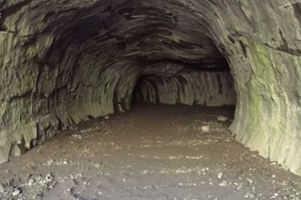
Embark on a subterranean adventure into a fascinating lava tube. This self-guided exploration covers an approximate distance of one-third of a mile and offers a unique glimpse into volcanic geology.

Trail Features

Prepare to be enveloped in complete darkness within the cave system, making a reliable flashlight essential for navigation and discovery.

For your comfort and safety, it is highly recommended that you wear sturdy, closed-toe shoes to negotiate the uneven and jagged cave floor.

The interior of the lava tube maintains a consistently cool temperature of around 46 degrees Fahrenheit (approximately 8 degrees Celsius), so bringing a light jacket is advisable to prevent any discomfort from the chill. Visiting the Subway Caves after hiking Cinder Cone is a great way to cool off.

There are two side caverns off the main cavern, Licifer’s cul-de-sac and the Sanctum.

The lava tube is 16-17 feet tall throughout, so no need for hard hards, stooping, or crawling.

Rescrictions

Please note that pets are not permitted within the lava tube to preserve this underground environment and the safety of all visitors.

Other Attractions Close By

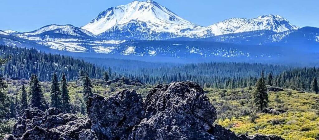
Hat Creek Rim Overlook is just east of the Subway Cave on Highway 44. It offers views of Lassen Peak and Mount Shasta.  The overlook is an interpretive site with signage and access to the Pacific Crest Trail. Picnic tables and vault toilets are located at the overlook, but no running water exists.

The Old Station Visitor Information Center is the hub of the Hat Creek recreation area. It is west of the Subway Caves on Highway 44. Interpretive displays include a living trout exhibit (seasonal) and gardens. It is a pleasant stop to get answers to your forest questions. Maps, wood cutting permits, Christmas tree permits (Nov- Dec), nature books, and interpretive items are available for sale.

Spattercone Trail is on the south side of Highway 44, between the Old Station Visitor Center and the NW entrance to Lassen Volcanic National Park.
Trail Difficulty

  • Check box with checkmark in it Easy

Trail details

  • Check box with checkmark in it Length: .3 miles
  • Check box with checkmark in it Elevation gain: 40 feet
  • Check box with checkmark in it Route type: Loop

Best Season to Hike

  • Check box with checkmark in it April - May
  • Check box with checkmark in it June - October

Region

Northwest Plumas

Address

40.685205, -121.418308

Managing agency contact

Explore nearby in Northwest Plumas
Upcoming events nearby
Chester
12:00 am
The Elegant Farmer
525 Main St

Enjoy summer evenings in Chester with local artisans, fresh flowers, food, beer and wine, and live music during The Elegant Farmer’s new Courtyard Market series.

6:00 pm - 8:00 pm
Waganupa Brewing
401 Peninsula Drive
Learn more
Lake Almanor
10:00 am
Blue Goose Gallery

Explore the traditional art of batik and create two beautiful textile pieces during this hands-on workshop.

Dining & entertainment nearby
Chester501 Main Street
530-816-1426
Visit website

Seasonal craft beers are on-tap in the bar. The restaurant offers pub fare and a menu with a variety of entrees and sides.

Chester669 Main Street
530-258-4226
Visit website

The Ranch House is a full service restaurant and bar with friendly staff and a beautiful back patio.

Chester525 Main Street
(530) 280-7900
Visit website

Beer & wine garden located in downtown Chester and just a stone's throw from gorgeous Lake Almanor. A garden setting for relaxing with friends.

Shopping nearby
Lake Almanor430 Peninsula Drive
(530) 596-3348
Visit website

We are your one stop for lake fun. We offer authentic cabin rentals too top of the line boat rentals.

Chester539 Main Street
(530) 259-4295
Visit website

Fresh produce, deli sandwiches, smoothies, milkshakes and homemade pies.

Chester, Ca525 Main Street
530-280-7900
Visit website

Rural sophistication! Unique, good quality decor to enhance the look and feel of any indoor or outdoor space.